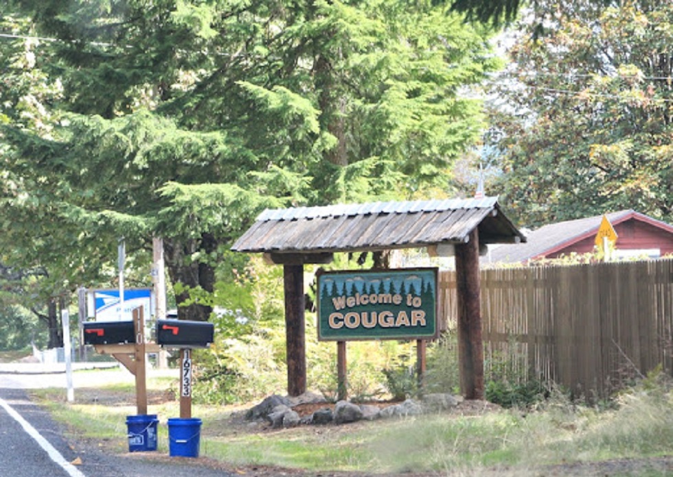
Cougar, Washington: Interesting Things About the Former Town
Cougar is located 30 miles northeast of Woodland. It can be found along the Washington State Route 503.
Author:Paolo ReynaReviewer:James PierceSep 26, 20206K Shares673.7K Views

Cougar is an unincorporated community belonging to the Cowlitz County in Washington. It used to be a town earlier but isn't anymore. Let's find out more about this interesting little place.
Cougar, Washinton: Where Is It And What All Does It Entail
Cougar is located 30 miles northeast of Woodland. It can be found along the Washington State Route 503. It's on the northwest bank of Yale Lake, a reservoir on the Lewis River. During the 1990 census, Cougar was still incorporated as a town and had a population of just 122 people. By the 2000 census, Cougar was disincorporated as a town. Cougar is located at 46°03′05″N 122°17′58″W (46.0514993, -122.2995413).
Which School District Covers Cougar, Washington?
The Woodland School District covers the Cougar community. It's a K-12 school district of about 2,200 students. Cougar is the nearest community to the famous Mount St. Helens volcano, which lies 13 miles (20.9215 km) to its northeast. The eruption of Mount St. Helens on May 18, 1980 was the deadliest and most economically destructive volcanic event in the history of the United States.
Why Is Cougar, Washington Called So?
The place is named after the animal, cougar. A post office with the name of COugar was established in 1902.
Has Cougar Had Any Celebrity Resident?
Gary Bennett, former Arista Records recording artist and founding member of the country band BR549 hails from Cougar, Washington.
What Are Some Things To Do In Cougar, Washington?
The small town of Cougar is located on the Lewis River and 11 miles from Mount St. Helens. Outdoor recreational activities are numerous. Fish for Kokanee, Coho, Steelhead or Rainbow Trout, go boating or swimming on the Lewis River. Explore the popular "Ape Caves" at Mount St. Helens or hike the miles of trails. Winter provides plenty of snow for cross country skiing and snow shoeing.
Lewis River
Lewis River passes south of Mount St. Helens forming the North-South boundary between Cowlitz County and Clark County. There are a lot of water activities that people can do on the Lewis River. Activities like fishing for Kokanee, Coho, Steelhead and Rainbow Trout, boating and personal watercraft.
Mount St. Helens
This famous volcano is located in the Cascade Mountains and for decades had been a favorite destination for local outdoor enthusiasts. After the notorious volcanic explosion in 1980, many new roads, viewpoints and miles of trails have been replaced or created for tourists to explore by car, mountain bike or foot. During the summer Forest Interpreters lead a wide range of activities, from short walks to amphitheater presentations. Some other popular tourist activities of this region include fishing in the lake that was created as a result of the 1980 eruption. Tourists can also explore the 12,810 foot-long lava tube known as "Ape Cave" located on the south side of the volcano.
Is Cougar, Washington Under Threat From The Washington Forest Fires?
Big Hollow Fire in Gifford Pinchot National Forest has burned through an area of 12,000 acres. The southwest portion of the national forest, that has developed campgrounds, dispersed camping and day-use areas has been closed.
The Siouxon Block and recreational sites of Merill Lake Conservation Area have been closed as per the order of the Washington State Department of Natural Resources.
The following evacuation orders have been issued in the areas under threat of the forest fire (including Cougar, Washington):
- A level 1 (get ready) evacuation order is in place for areas around Swift Reservoir and south of Lake Merwin.
- A level 2 (get set) evacuation order is in place for areas around Yale Lake.
The southwestern part of Oregon and Washington has also been alerted for depleting air quality. The smoke rising from the wildfire can create hazardous conditions for the people living in the area.
Jump to

Paolo Reyna
Author
Paolo Reyna is a writer and storyteller with a wide range of interests. He graduated from New York University with a Bachelor of Arts in Journalism and Media Studies.
Paolo enjoys writing about celebrity culture, gaming, visual arts, and events. He has a keen eye for trends in popular culture and an enthusiasm for exploring new ideas. Paolo's writing aims to inform and entertain while providing fresh perspectives on the topics that interest him most.
In his free time, he loves to travel, watch films, read books, and socialize with friends.

James Pierce
Reviewer
James Pierce, a Finance and Crypto expert, brings over 15 years of experience to his writing. With a Master's degree in Finance from Harvard University, James's insightful articles and research papers have earned him recognition in the industry.
His expertise spans financial markets and digital currencies, making him a trusted source for analysis and commentary. James seamlessly integrates his passion for travel into his work, providing readers with a unique perspective on global finance and the digital economy.
Outside of writing, James enjoys photography, hiking, and exploring local cuisines during his travels.
Latest Articles
Popular Articles